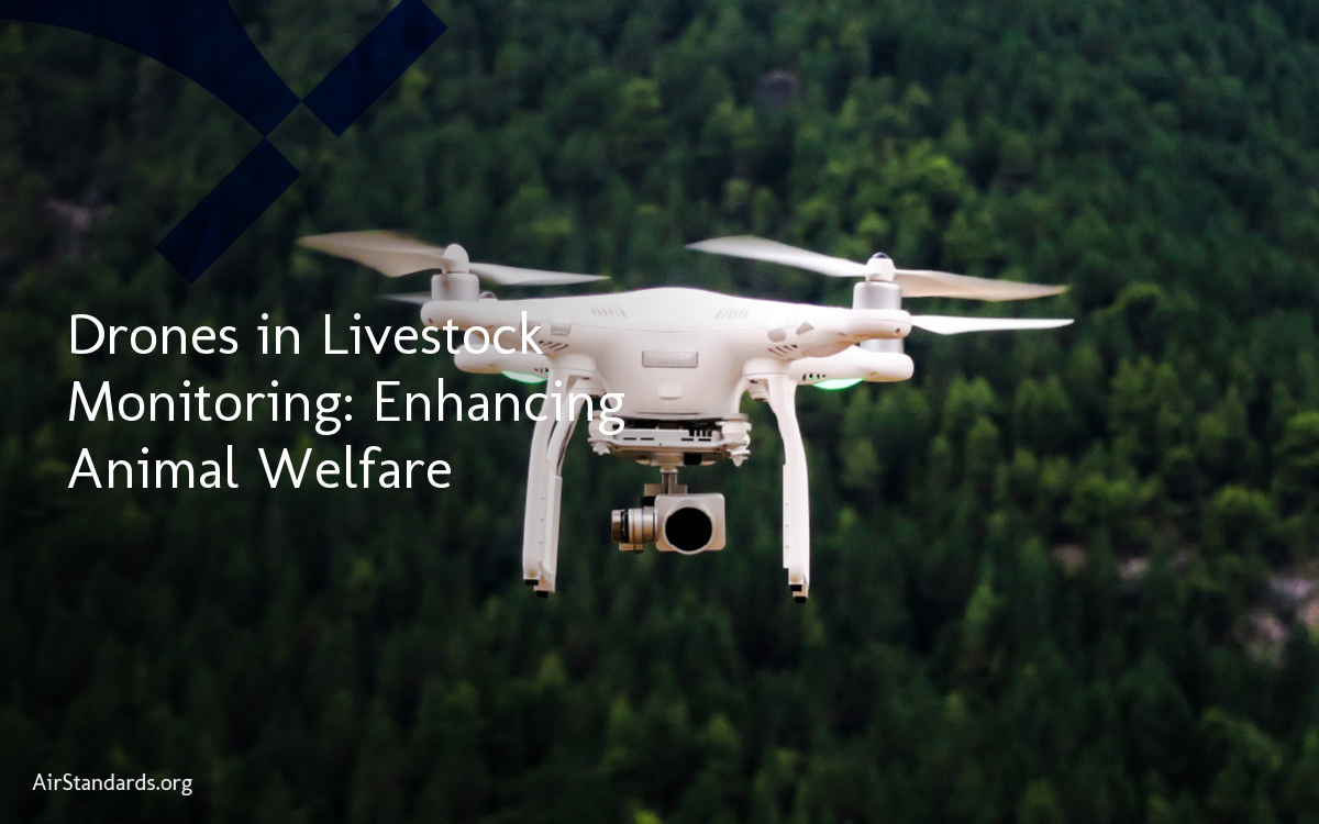
We are excited to explore the incredible advancements in precision agriculture and the transformative role that drones play in ensuring accurate farming practices. With the rapid growth of technology, drones have become indispensable tools for farmers, providing them with invaluable data and analytics to optimize crop yields, improve efficiency, and reduce costs.
Precision agriculture involves the use of drones equipped with advanced imaging technologies that revolutionize the way farmers monitor crop health, detect pests and diseases, and optimize irrigation and fertilizer application. By harnessing the power of drones, farmers can make data-driven decisions and take precise actions to maximize productivity, resulting in higher crop yields and healthier plants.
In this article, we will delve into the various aspects of how drones are transforming precision agriculture. From crop monitoring to weed control, soil inspection to water management, we will explore the incredible capabilities of drones and their impact on accurate farming. Join us as we discover the future of farming and the critical role that drones play in shaping it.
The Role of Drones in Precision Agriculture
In the realm of precision agriculture, drones have emerged as indispensable tools for optimizing farming practices. These advanced flying devices play a crucial role in various aspects, including crop monitoring, imaging technologies, and data analytics. Equipped with state-of-the-art imaging sensors, drones provide real-time, site-specific information about crop health and potential issues, aiding farmers in making informed decisions to maximize productivity.
Enhancing Crop Monitoring and Analysis
Drones equipped with hyperspectral and thermal sensors enable precise crop monitoring and analysis. By capturing high-resolution images and thermal data, drones can detect early signs of plant stress, disease, and pest infestation. This data allows farmers to take timely action, implementing targeted interventions to ensure the health and productivity of their crops. Drones also provide crucial insights into soil conditions, allowing farmers to optimize irrigation and fertilizer application, reducing waste and environmental impact.
Surveying Damage and Assessing Unreachable Areas
After natural disasters, such as floods or storms, drones can survey the extent of damage in agricultural areas that are difficult to access. By capturing aerial images, drones provide farmers with valuable information to assess and plan for recovery. In combination with mapping technologies, drones can create detailed 2D and 3D maps of fields, helping farmers analyze changes over time and make informed decisions about soil management, planting, and harvesting.
| Advantages of Drones in Precision Agriculture |
|---|
| Detect early signs of plant stress, diseases, and pests |
| Optimize irrigation and fertilizer application |
| Survey damage after natural disasters |
| Create detailed maps for soil management |
The utilization of drones in precision agriculture is revolutionizing the industry, providing farmers with invaluable insights and data. By leveraging the capabilities of drones, farmers can enhance crop yields, reduce costs, and optimize resource management. As drone technology continues to advance, the future of precision agriculture looks promising, with further integration of robotics and artificial intelligence facilitating even more precise and automated farming operations.
Crop Surveying and Mapping with Drones
Drones have revolutionized crop surveying and mapping in precision agriculture. By utilizing advanced technologies such as time-lapse drone photography and NDVI mapping, drones provide accurate and detailed information about crop growth, pests, diseases, and stress levels in plants. This data enables farmers to make timely interventions and adjustments to ensure higher productivity and optimize crop health.
With the help of drones equipped with photogrammetry software, farmers can create comprehensive 2D maps and 3D models of their fields. These detailed representations allow for in-depth analysis of changes over time, helping farmers make informed decisions regarding soil management, planting strategies, and harvesting schedules. This information is invaluable in maximizing the efficiency of farming operations and improving overall crop yields.
Table: Benefits of Crop Surveying and Mapping with Drones
| Benefits | Description |
|---|---|
| Accurate Monitoring | Drones provide real-time, site-specific data on crop health, pests, diseases, and stress levels, enabling farmers to take immediate action. |
| Timely Interventions | By detecting issues early on, farmers can make necessary interventions and adjustments to prevent further crop damage and optimize productivity. |
| Improved Decision-making | Detailed maps and models created by drones allow farmers to analyze changes over time and make informed decisions regarding soil management, planting, and harvesting. |
| Enhanced Efficiency | Precise data from drones helps optimize farming operations, reduce resource wastage, and increase overall efficiency. |
In summary, drones have revolutionized the way farmers survey and map their crops. Through advanced imaging technologies and data analysis, drones provide accurate and timely information that helps farmers make informed decisions to maximize productivity, optimize crop health, and improve overall efficiency.
Weed and Pest Control Management with Drones
Drones are revolutionizing weed and pest control management in precision agriculture. Equipped with advanced imaging technologies and multispectral sensors, drones provide farmers with crucial insights for targeted strategies and efficient crop protection. Here, we explore how drones play a vital role in weed control and pest management, offering significant benefits to farmers.
Weed Control
Drones equipped with specialized cameras and sensors can identify and map out weeds in fields with exceptional accuracy. This information allows farmers to plan targeted interventions and implement precise herbicide application. By applying herbicides only where needed, farmers can reduce the use of chemicals, minimize environmental impact, and save costs. Additionally, drones enable farmers to monitor the effectiveness of weed control measures over time, providing valuable data for ongoing management.
Pest Management
Drones equipped with multispectral sensors provide valuable insights into pest populations and their distribution across fields. By identifying pest hotspots, farmers can develop targeted pest management strategies, minimizing the use of pesticides and reducing the risk of resistance development. Drones also enable farmers to assess the impact of pest infestations on crop health, allowing for timely interventions and preventive measures. Aerial spraying of crop protection products with drones ensures even coverage and reduces the spread of pests and diseases, leading to healthier crops and increased yields.
| Weed and Pest Control Benefits with Drones | |||
|---|---|---|---|
| 1. Targeted interventions and precise herbicide application | • Reduced use of chemicals | • Minimized environmental impact | • Cost savings |
| 2. Insights into pest populations and distribution | • Effective pest management strategies | • Reduced pesticide use | • Decreased resistance development |
| 3. Timely interventions and preventive measures | • Assessing impact on crop health | • Improved crop protection | • Increased yields |
In conclusion, drones equipped with advanced imaging technologies and multispectral sensors provide farmers with crucial tools for weed and pest control management. Through targeted interventions, precise herbicide application, and effective pest management strategies, farmers can reduce chemical usage, minimize environmental impact, and optimize crop protection. The use of drones in weed and pest control not only enhances agricultural practices but also contributes to sustainable farming and increased productivity in precision agriculture.
Soil Inspection and Health Monitoring with Drones
In precision agriculture, drones have become indispensable tools for soil inspection and health monitoring. Equipped with advanced multispectral sensors, drones provide real-time measurements and data to help farmers make informed decisions about soil management, nutrient application, and crop placement. By monitoring soil conditions throughout the growing season, farmers can proactively address any issues and optimize land management practices to enhance crop yields and reduce environmental impact.
One of the key benefits of using drones for soil inspection is the ability to create detailed soil quality maps. By collecting data on soil density, nutrient levels, and moisture content, drones can generate accurate maps that highlight variations across the fields. These maps enable farmers to identify areas that may require additional attention or adjustments in irrigation, fertilization, or drainage. By targeting specific areas with tailored interventions, farmers can maximize the efficiency of their resources and minimize waste.
Real-time Measurements and Analysis
Another advantage of using drones for soil inspection is the ability to collect real-time measurements and perform on-site analysis. Multispectral sensors on drones can capture data on soil moisture, temperature, and other relevant parameters while flying over the fields. This real-time information allows farmers to assess soil conditions as they change and make timely decisions regarding irrigation, water management, and crop health.
| Soil Parameter | Measurement Range | Ideal Range |
|---|---|---|
| Soil Moisture | 10-40% | 20-30% |
| Soil pH | 6.0-7.5 | 6.5-7.0 |
| Organic Matter | 1-5% | 3-4% |
The table above showcases the typical measurement ranges and ideal ranges for key soil parameters. With real-time measurements from drones, farmers can quickly identify any deviations from the ideal range and take appropriate actions to maintain optimal soil health. This proactive approach helps prevent nutrient deficiencies, imbalances, and other issues that can negatively impact crop growth and productivity.
In conclusion, drones offer a valuable tool for soil inspection and health monitoring in precision agriculture. By providing real-time measurements, data analysis, and detailed soil quality maps, drones empower farmers to make informed decisions about soil management and improve overall crop health. With the ability to optimize land management practices and reduce environmental impact, drones play a crucial role in the future of sustainable farming.
Irrigation and Water Management with Drones
Drones have become invaluable tools for precision agriculture, playing a vital role in irrigation and water management. Equipped with thermal sensors, drones provide real-time information about moisture levels in the soil, allowing farmers to optimize their irrigation practices and promote water efficiency. By monitoring soil moisture with drones, farmers can prevent overwatering, reduce water pollution, conserve water resources, and minimize the environmental impact of farming operations.
With the help of thermal sensors, drones can accurately detect variations in soil moisture levels, even in large agricultural fields. This data allows farmers to make informed decisions about when and where to irrigate, ensuring that water is applied efficiently and only when necessary. By avoiding unnecessary water use, farmers can reduce their water consumption and lower costs, while also contributing to sustainable farming practices.
Furthermore, drones equipped with thermal sensors enable farmers to identify areas within their fields that may suffer from poor drainage or excessive moisture retention. By pinpointing such problem areas, farmers can implement targeted drainage solutions or adjust their irrigation strategies accordingly. This precise approach to water management not only improves crop health and productivity but also helps maintain the long-term sustainability of agricultural practices.
| Benefits of Irrigation and Water Management with Drones | Examples |
|---|---|
| Water Efficiency | Drones provide real-time data on soil moisture, enabling precise irrigation practices that minimize water waste. |
| Cost Reduction | By optimizing irrigation, farmers can reduce their water consumption and lower operational costs. |
| Environmental Impact | Precise water management with drones helps conserve water resources and minimize the ecological footprint of farming operations. |
| Sustainability | By promoting water efficiency and reducing water pollution, drones contribute to more sustainable agricultural practices. |
Conclusion
Drones have revolutionized irrigation and water management in precision agriculture. With their ability to provide real-time data on soil moisture, drones enable farmers to optimize their irrigation practices, reduce water waste, lower costs, and promote sustainable farming practices. By harnessing the power of thermal sensors, drones have become invaluable tools for improving water efficiency and minimizing the environmental impact of farming operations. As drone technology continues to advance, the future of precision agriculture looks bright, offering farmers even more opportunities to enhance their irrigation and water management practices.
Types of Drones Used in Agriculture
Drones play a pivotal role in precision agriculture, offering a range of capabilities to meet the diverse needs of farmers. Different types of drones bring unique advantages and are suited for various farming operations. Let’s explore the most common types of drones used in agriculture:
Fixed-wing Drones
Fixed-wing drones resemble airplanes and are ideal for large-scale aerial monitoring and data collection. These drones can cover extensive areas efficiently and provide valuable insights into crop health, soil conditions, and environmental factors. With their long flight endurance and stable flight characteristics, fixed-wing drones are particularly useful for mapping and surveillance tasks in precision agriculture.
Multi-rotor Drones
Multi-rotor drones, characterized by their compact size and maneuverability, are widely used for mapping, modeling, and monitoring in precision agriculture. These drones can hover at specific locations, capturing detailed images and collecting data with high precision. They are ideal for tasks that require close proximity to crops and need quick deployment, such as inspecting individual plants or detecting potential issues in small areas.
Hybrid VTOL Drones
Hybrid VTOL (Vertical Take-Off and Landing) drones offer a combination of fixed-wing and multi-rotor capabilities, providing flexibility in various farming operations. These drones can take off and land vertically like a helicopter and then transition to horizontal flight like a plane. Hybrid VTOL drones are advantageous when both large-area coverage and pinpoint accuracy are required, making them suitable for tasks like crop surveying, mapping, and spraying.
Single-rotor Helicopter Drones
Single-rotor helicopter drones are designed for precision applications in agriculture. These drones offer superior stability, payload capacity, and endurance, making them well-suited for tasks that require high precision and control. Single-rotor drones are commonly used for activities like crop spraying, precision fertilization, and monitoring hard-to-reach areas. Their vertical take-off and landing capabilities enable efficient operations in challenging terrains and complex farming environments.
| Type of Drone | Advantages | Applications |
|---|---|---|
| Fixed-wing Drones | Efficient aerial monitoring Long flight endurance Stable flight characteristics |
Large-scale mapping and surveillance Environmental monitoring Crop health assessment |
| Multi-rotor Drones | Compact and maneuverable Precise data collection Quick deployment |
Crop inspection and monitoring Pest and disease detection Small-area mapping |
| Hybrid VTOL Drones | Combination of fixed-wing and multi-rotor capabilities Vertical take-off and landing Large-area coverage and pinpoint accuracy |
Crop surveying and mapping Aerial spraying Site-specific interventions |
| Single-rotor Helicopter Drones | Superior stability and payload capacity Vertical take-off and landing High precision and control |
Crop spraying Precision fertilization Monitoring challenging terrains |
The Future of Precision Agriculture with Drones
In the rapidly evolving field of precision agriculture, drones are poised to play a pivotal role in shaping the future of farming. With continued advancements in drone technology, we can expect even greater integration of drones into farming operations, leading to increased efficiency, productivity, and sustainability.
One of the key future trends in precision agriculture is the convergence of drones with robotics and artificial intelligence. By combining the capabilities of drones with autonomous robots and sophisticated algorithms, farmers can benefit from data-driven decision-making and automated actions. This integration enables smart farming practices, where drones can autonomously monitor crop health, detect pest and disease outbreaks, and optimize farming operations without human intervention.
Furthermore, the future of precision agriculture with drones holds exciting possibilities in terms of enhanced data analytics. By collecting vast amounts of data through advanced imaging technologies, drones can provide farmers with valuable insights into crop performance, soil health, and weather patterns. These insights can be leveraged to optimize resource allocation, improve irrigation management, and maximize crop yields.
Another area of future development in precision agriculture is the utilization of drones for targeted application of inputs. With advanced sensing technologies, drones can precisely deliver fertilizers, pesticides, and other inputs only where and when they are needed. This targeted approach minimizes waste, reduces environmental impact, and maximizes the effectiveness of inputs, leading to more sustainable farming practices.

- SMED Manufacturing: Reduce Changeover Times & Boost Efficiency - January 30, 2026
- Aviation Lifecycle Services: Maximizing Safety, Efficiency, and Compliance Through Digital Strategies - December 1, 2025
- Syringe Pump Automation: Elevating Laboratory Standards - November 3, 2025